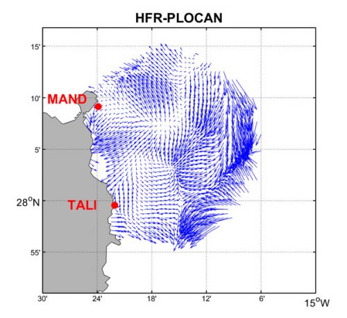
HFR-PLOCAN
HFR system name:
HFR-PLOCAN
Spatial location:
Atlantic Ocean
Sites (frequency):
HFR-PLOCAN-MAND (25.95 MHz), HFR-PLOCAN-TALI (25.95 MHz)
Manufacturer:
CODAR
Owning institution:
PLOCAN
Operating institution:
PLOCAN
EDMO code:
3497
Contact names:
Tania Morales
Contact emails:
tania.morales@plocan.eu
DOI:
Time coverage:
2017 - present
Description:
The data set consists of near-real time surface ocean velocity in the North-East coast of Gran Canaria averaged over a time interval of 1 hour around the cardinal hour. Surface ocean velocities estimated by HF Radar are representative of the upper 0.5 meters of the ocean. Total velocities are derived using least square fit that maps radial velocities measured from individual sites onto a cartesian grid. The final product is a map of the horizontal components of the ocean currents on a regular grid in the area of overlap of two radar stations, one located at PLOCAN on shore facilities and the other at Las Palmas harbour.
Publications:
HFR Radar data were acquired and published by the Oceanic Platform of the Canary Islands (PLOCAN).

