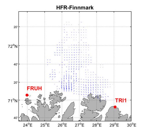
HFR-Finnmark
HFR system name:
HFR-Finnmark
Spatial location:
Baltic Sea
Sites (frequency):
HFR-Finnmark-BERL (4.453 MHz), HFR-Finnmark-FRUH (4.453 MHz)
Manufacturer:
CODAR
Owning institution:
Norwegian Meteorological Institute
Operating institution:
Norwegian Meteorological Institute
EDMO code:
1212
Contact names:
Snorre Ronning
Contact emails:
snorre.ronning@met.no
DOI:
Time coverage:
2017 - present
Description:
The data set consists of maps of total velocity of the surface current along the Finnmark coast averaged over a time interval of 1 hour around the cardinal hour. Surface ocean velocities estimated by HF Radar are representative of the upper 0.3-2.5 meters of the ocean.
Publications:
HFR-Finnmark Radar Network has been designed, implemented and managed through the efforts of the Norwegian Meteorological Institute.

